Focus On Embodied Intelligent Special-Purpose Robots Of Confined Spaces


EN

PRODUCTS
|
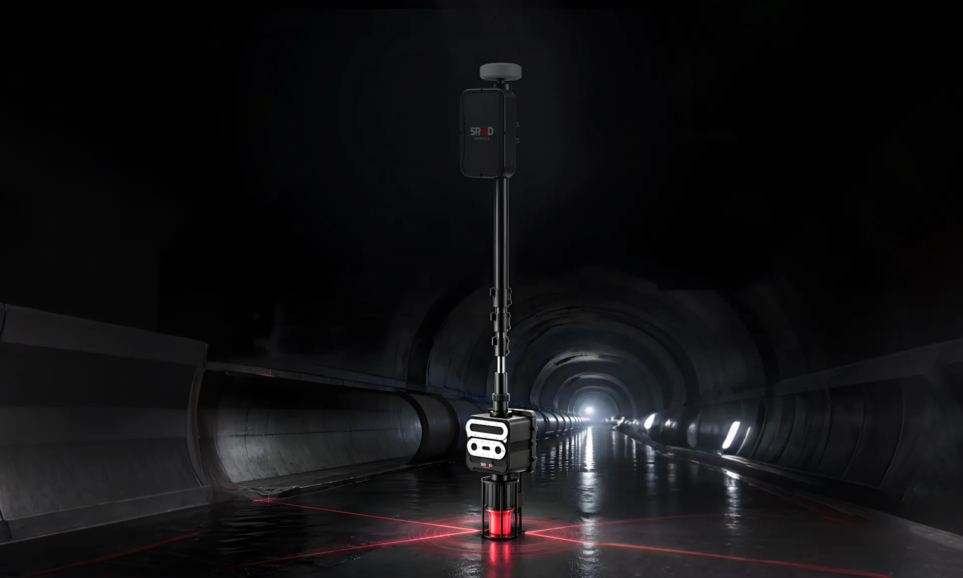
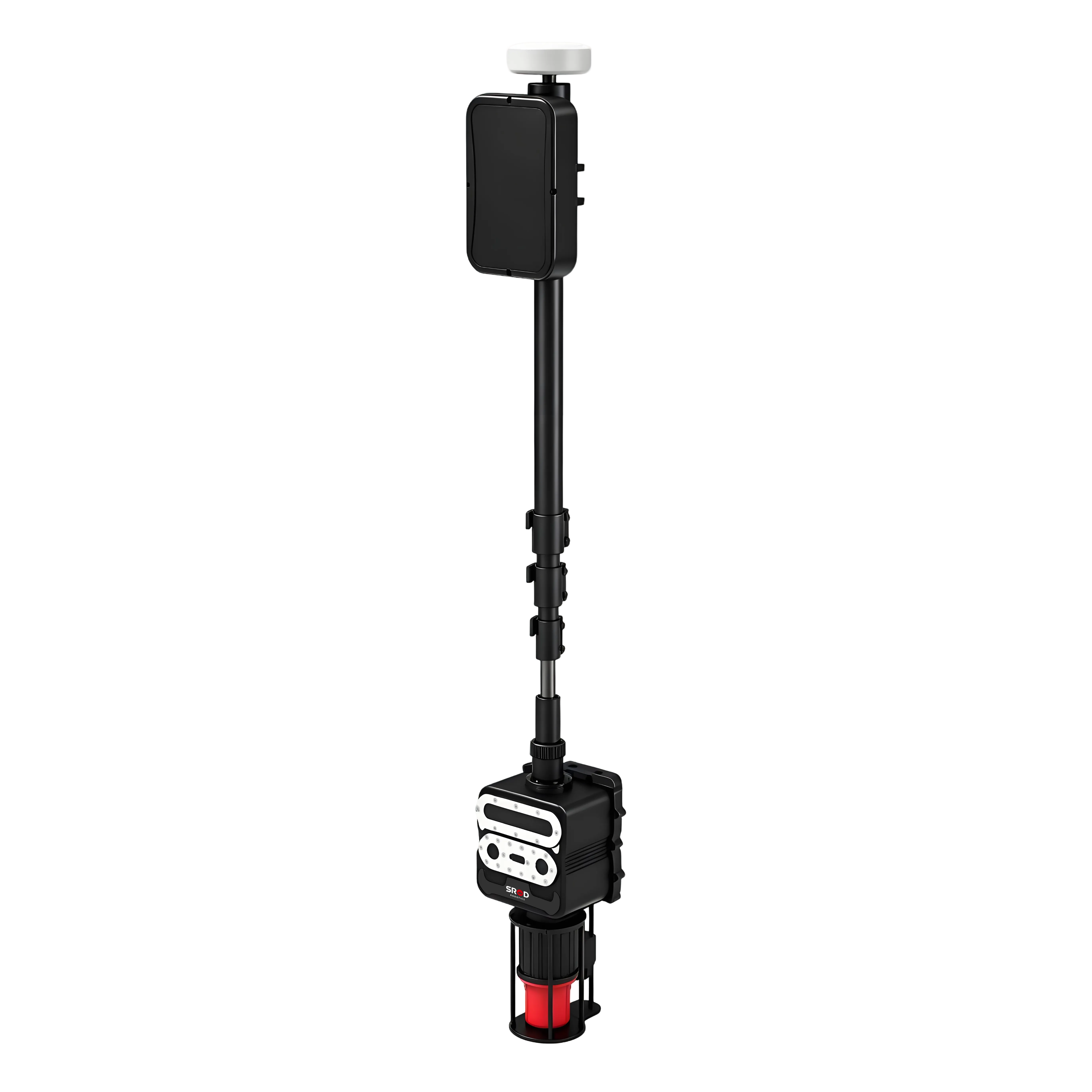
M300 PLUS Intelligent 3D Pipe Mapping Instrument
Acoustic Imaging + Infrared Laser Imaging + Optical Imaging Tri-Mode Synergy
The M300 PLUS Intelligent 3D Pipeline Mapper is the industry's first portable testing device designed for measuring basic data of underground pipeline networks.The device is equipped with a 360° surround-scanning pipeline sonar system and a high-precision depth camera, utilizing a three-mode synergy of acoustic imaging, infrared laser imaging, and optical imaging.It can accurately obtain core parameters such as pipe diameter, burial depth, coordinates, and three-dimensional dimensions, and is suitable for underground pipeline mapping and geophysical exploration, pipeline network operation and maintenance, and project acceptance.
|
|
M300 PLUS Intelligent 3D Pipe Mapping Instrument
Acoustic Imaging + Infrared Laser Imaging + Optical Imaging Tri-Mode Synergy
The M300 PLUS Intelligent 3D Pipeline Mapper is the industry's first portable testing device designed for measuring basic data of underground pipeline networks.The device is equipped with a 360° surround-scanning pipeline sonar system and a high-precision depth camera, utilizing a three-mode synergy of acoustic imaging, infrared laser imaging, and optical imaging.It can accurately obtain core parameters such as pipe diameter, burial depth, coordinates, and three-dimensional dimensions, and is suitable for underground pipeline mapping and geophysical exploration, pipeline network operation and maintenance, and project acceptance.
|
PRODUCT HIGHLIGHTS
 |
 |
 |
|
Tri-Mode Collaborative Measurement It accurately acquires core parameters such as pipe diameter, burial depth, coordinates, and three-dimensional dimensions, with a measurement error of millimeter level (<1%)
|
Precise Pipe Diameter Identification Real-time acquisition of pipe profile data, automatic execution of 3D cylinder fitting algorithm, and output of pipe diameter result |
Smart Pipeline Connection The built-in point-line connection module generates a pipeline topology map in real time from measurement data, achieving unified data exchange between office and field operations |
 |
 |
 |
|
3D Sonar Modeling of Water-Filled Wells Under full-water manhole conditions, underwater scanning is performed using 360° surround sonar to construct a real-time 3D point cloud model of the manhole and pipeline |
Laser Alignment Elevation Measurement Non-contact elevation measurement using infrared laser imaging technology allows for the acquisition of pipe top elevation data without going down into the well |
Cloud Data Management Test data can be uploaded to the cloud with one click, enabling remote management and multi-terminal collaboration, and supporting subsequent data analysis and asset management |
|
Technical Parameters
|
|
PRODUCT HIGHLIGHTS
|
|
|
Tri-Mode Collaborative Measurement It accurately acquires core parameters such as pipe diameter, burial depth, coordinates, and three-dimensional dimensions, with a measurement error of millimeter level (<1%) |
3D Sonar Modeling of Water-Filled Wells Applicable to no water, half water and full water conditions |
|
|
|
Precise Pipe Diameter Identification Real-time acquisition of pipe profile data, automatic execution of 3D cylinder fitting algorithm, and output of pipe diameter result |
Laser Alignment Elevation Measurement Non-contact elevation measurement using infrared laser imaging technology allows for the acquisition of pipe top elevation data without going down into the well |
|
|
|
Smart Pipeline Connection The built-in point-line connection module generates a pipeline topology map in real time from measurement data, achieving unified data exchange between office and field operations |
Cloud Data Management Test data can be uploaded to the cloud with one click, enabling remote management and multi-terminal collaboration, and supporting subsequent data analysis and asset management |
Technical Parameters
Application Scenario Cases
 |
 |
 |
 |
 |
 |
Application Scenario Cases
Message
GOT FREE INQUIRY NOW

Copyright © 2009-2026 SHENZHEN SROD INDUSTRIAL GROUP CO.,LTD.